Suriname


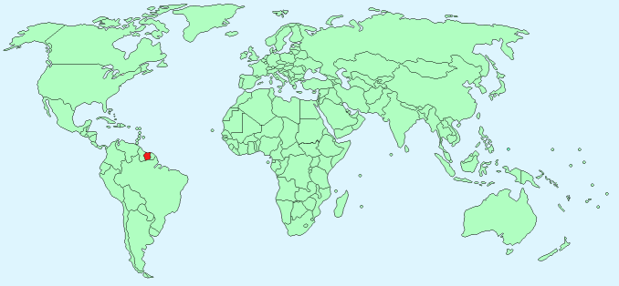
Continent – South America
Region – N/A
Size – 163,820km²
Geography – rolling hills with coastal plain
Language – Dutch, English, Surinamese
Religion -Hindu 27.4%, Protestant 25.2%, Roman Catholic 22.8%, Muslim 19.8% other 4.8%
Monetary Unit -Surinamese dollar
Natural Resources – timber, hydropower, fish, kaolin, shrimp, bauxite, gold
Agriculture – rice, bananas, palm kernels, coconuts, plantains, peanuts, beef, chickens, shrimp, forest products
Industry – bauxite and gold mining, alumina production, oil, lumbering, food processing, fishing

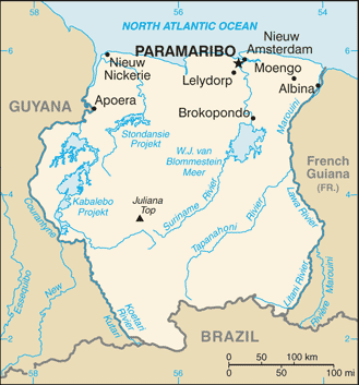
Neighbouring Countries – Guyana, French Guiana, Brazil
Population – 579,633 (2015 estimate)
Population Growth Rate – 1.08%
Average Life Expectancy – 71.97 years
Capital City – Paramaribo (234,000)
Highest Mountain – Juliana Top (1,230 m)
Longest River – Courantyne River (724 km)
Climate -tropical, hot all year 23°C – 33°C
Yearly Rainfall – 220cm (approx)
Plant Life – rainforest trees, water lilies, orchids, hibiscus, bougainvillea, oleander
Animal Life – tortoise, iguana, caiman, snakes, blue poison dart frog, giant armadillo, capybara, anteater, wild boar, spider monkey, howler monkey, tapir, ocelot
Bird Life– egret, toucan, hummingbird, macaw, humming bird, Ibis
Harvard Reference for this page:
Heather Y Wheeler. (2016). Suriname. Available: https://www.naturalhistoryonthenet.com/Facts_Figures/Country_Facts/suriname.htm. Last accessed Thursday, July 21, 2016
Facts and Figures Pages
